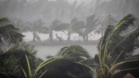
For now, it does not seem likely to affect the Indian coast as models indicate that Asani may cross Bangladesh or adjoining north Myanmar coasts.
This year’s first cyclone—Asani—is likely to form over the central Bay of Bengal on 21 March. It is unlikely to cross the Indian coast but heavy rain and strong winds are expected over Andaman and Nicobar Islands, India Meteorological Department (IMD) said.
A low-pressure area was formed over the equatorial Indian Ocean and the southwest Bay of Bengal on Tuesday evening. It was over central south Bay of Bengal on Wednesday. The low-pressure area is likely to move and become a well-marked low-pressure area over the southeast Bay of Bengal and the Andaman Sea around 19 March. Thereafter, it is likely to move north-north-westwards along and off Andaman and Nicobar Islands and intensify into a depression by the morning of March 20 and cyclonic storm Asani on 21 March, IMD said.
“For now, it does not seem like it will affect the Indian coast. Our models indicate Asani may cross Bangladesh or adjoining north Myanmar coasts. But it is also too early to say what will be the trajectory. All conditions are favourable for formation and intensification of the cyclone,” said an IMD official.
On 19 March, light to moderate rainfall/thundershowers are likely in the south Andaman Sea. Heavy to very heavy rainfall is expected at a few places and extremely heavy rainfall at isolated places in Andaman and Nicobar Islands.
Strong winds reaching 40-50 kmph gusting to 60 kmph are very likely over the Bay of Bengal and the equatorial Indian Ocean till 18 March. Wind speed is gradually expected to increase by March 21. Gale winds speed reaching 70-80 kmph gusting to 90 kmph are very likely over Andaman and Nicobar Islands and the Bay of Bengal. On 23 March, gale winds speed reaching 70-80 kmph gusting to 90 kmph are very likely over the Bay of Bengal and Bangladesh and Myanmar coasts.
“If the forecast materialises, Tropical #CycloneAsani will become the first ever tropical cyclone to hit Andaman and Nicobar Islands in March. Not a single tropical cyclone has hit the region in March in at least 132 years,” tweeted Akshay Deoras, a meteorologist at the University of Reading, UK.
A heatwave is also affecting parts of the country. Maximum temperatures of 39-41 degrees Celsius were recorded on Tuesday in some parts of Gujarat, Rajasthan, Madhya Pradesh, Vidarbha, and Telangana.
“The sky is also clear. So, there is more solar radiation and warming. Along the west coast, the reason for very high temperatures is different. It is mainly because of easterly winds which have weakened the sea breeze over Mumbai and Konkan. Dry, warm easterlies are blowing along the west coast,” said DS Pai, a former IMD scientist.
No significant change is expected in maximum temperatures in northwest India over the next two to three days. There may be some relief thereafter due to a western disturbance on 19 and 20 March.
IMD director general M Mohapatra said central India has also recorded heatwaves in March. “In our long-range forecast for March, we have said these areas particularly Gujarat, southwest Rajasthan, Maharashtra, Odisha are likely to record very high temperatures. The immediate reason for such high temperatures is the south-easterly wind blowing towards central India from very warm regions.”
Skymet Weather vice president (climate and meteorology) Mahesh Palawat said dry and hot winds from the Thar desert were blowing across parts of north and central India. “This is why maximum temperatures have spiked. Now gradually wind direction will start changing. In the next 24-48 hours, there may be marginal relief.”
Council on Energy, Environment, and Water (CEEW) Programme Lead Abinash Mohanty said IMD’s recent heatwave warning highlights the impact of climate extremities in recent years, which aligns with the projection of the Intergovernmental Panel on Climate Change report. “The increase in intensity and frequency of extreme events like heat waves is a result of human-induced landscape disruption and micro-climate change, leading to temperature and precipitation anomalies.”
Mohanty said CEEW’s Climate Vulnerability Index suggests Indian districts have undergone a 45% change in their landscape attributes (tree cover, forest coves, wetlands, mangroves, among others), thereby triggering these heat extremities. “Rapid deployment of nature-based solutions can mitigate the impact of micro-climate changes and heatwaves. They also pay a double dividend of enhancing resilience, as well as generating socio-economic and environmental benefits that can climate-proof lives and livelihoods.”


